
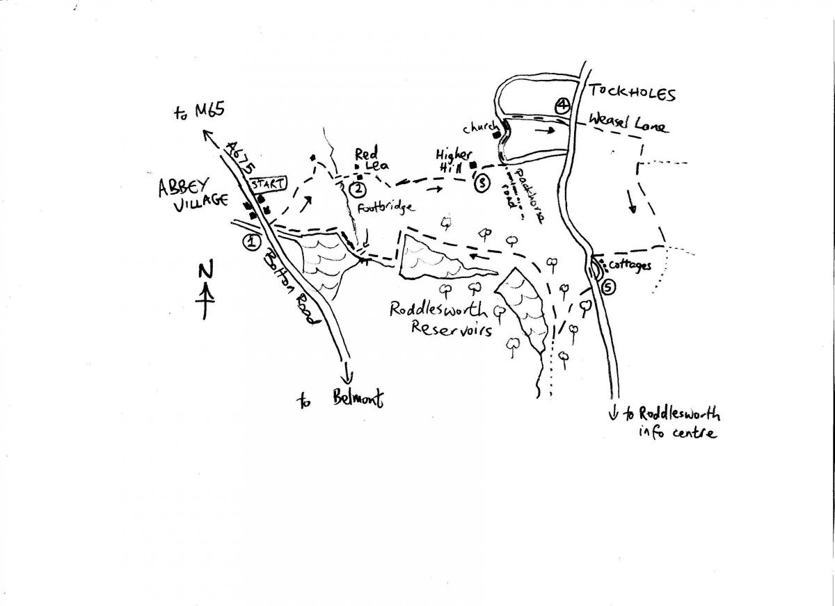
THIS walk links the industrial villages of Tockholes and Abbey Village through a variety of old tracks, field and woodland paths.
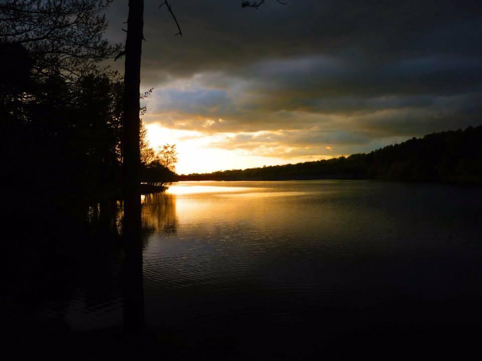
The upper valley of the River Roddlesworth was flooded to form several Victorian reservoirs as part of the Liverpool Corporation scheme that had already created the large reservoirs at Anglezarke and Rivington.
Whilst Abbey Village’s terraces developed with the mill, the straggling village of Tockholes is a good example of Lancashire’s early textile industry where handloom weavers operated in their farms and cottages and relied on the well developed system of packhorse roads. This walk encounters one of these old routes linking Preston with Rossendale.
1. Join the access road to the right of the Hare and Hounds car park. Do not turn right but go straight ahead past new houses on the left. The driveway keeps a wall on the immediate left and a field on the right. When it reaches houses the drive swings right downhill, keep to it and it then swings right again continuing downhill. At the bottom of the hill look out on the left for a footbridge (often hidden by the vegetation) and cross this over a stream. Steps lead uphill to the rear garden of an old farm, Red Lea.
2. Keep to the waymarked path that runs along the left hand side of the paddock behind the farm and emerges in the courtyard between the farm buildings. Bear diagonally right to the right corner of the farm buildings and join the track leading out of the farm. Ignore the metal gate on the right but cross the stile on the right to follow a waymarked path along a track towards sheep pens. As you approach the field gates cross the stile on the left leading to another stile. You then continue straight ahead gradually uphill through a large field. Head for a stile (not the gate) on the opposite side of this field and cross this, turning left along a track to old farms and cottages at Higher Hill.
3. Continue straight ahead along the track leading away from the cottages and a crossroads at a lane is reached. On your left here is the old walled graveyard of the nearby church. On the left side of the track leading off right is the walled pinfold of Tockholes (there is an info board) where stray cattle were housed. The bridleway track leading off to the right is also a section of the packhorse route linking Preston with Rossendale. Turn left at the crossroads towards the Tockholes United Reform Church. Follow the lane swinging right and left around the front of the church. After passing the church turn first right uphill along Long Lane. This straight lane climbs steeply uphill to meet the main road through Tockholes village.
4. Go straight across the main road to continue along Weasel Lane directly opposite. This becomes a farm track which, on a clear day, gives good view north to Bowland and Penyghent. The track turns right and keep going straight ahead along it ignoring the track junction on the left by the farm. The track heads south in the direction of Darwen Moor. At the next track junction turn sharp right and follow a bridleway that runs back to the road. Take care and cross this to turn left along the pavement on the opposite side. A gate at the entrance to Roddlesworth Woods is soon reached on the right.
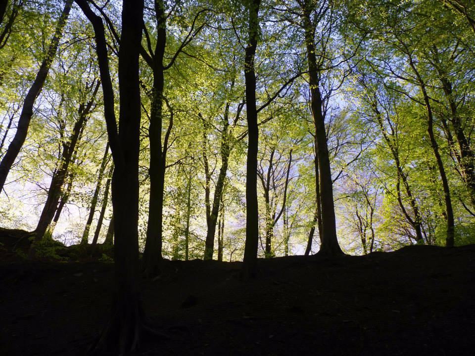
5. Enter the woods at these gates on the right and follow the path steeply downhill, it bears left and rejoins a lower track. Turn right along the lower track and follow this straight ahead as it runs uphill and downhill through the woods overlooking the Roddlesworth Reservoirs. Keep to this main track and eventually it turns left and crosses the dam of the lower reservoir. On the far side of the dam ignore the bridge straight ahead but turn right along the track and soon a lower bridge over the weirs is reached on the left. Cross this and go straight ahead up the steps by the house. Turn right along the access track which soon leads back to the Hare & Hounds inn.


Comments: Our rules
We want our comments to be a lively and valuable part of our community - a place where readers can debate and engage with the most important local issues. The ability to comment on our stories is a privilege, not a right, however, and that privilege may be withdrawn if it is abused or misused.
Please report any comments that break our rules.
Read the rules here